Mapping Access
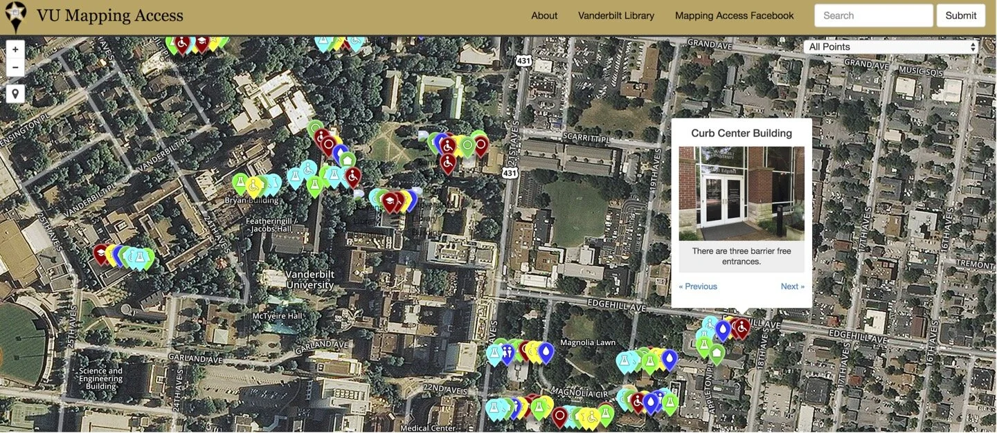
Image description: sample Vanderbilt University campus accessibility map. Text at top says “VU Mapping Access, About, Vanderbilt Library, and Mapping Access Facebook.” Image shows an aerial photographic view of the campus, with trees, buildings, and streets. Dots in multiple bright colors cover the map. A pop-up from one dot says “Curb Center Building,” showing the glass door entrance to a red brick building. Text on the pop up says “There are three barrier-free entrances.”
The architecture of inclusion too frequently relies on codes and standards to define disability access. Building codes can create access, but compliance with codes alone can also produce complacency. User expertise becomes a technical problem to solve through design solutions. The question remains: how can access be understood as an issue of collective spatial concern, an emergent quality of built environments, a project that is always in production? And how can studying built environments collaboratively yield more critical modes of attention to injustice?
Mapping Access draws on social practice, participatory mapping, and digital media to produce more critical forms of collective access. Through carefully-staged Map-a-Thon events featuring collective and relational forms of accessibility, this work disrupts narratives of easy code compliance as access, leaning instead into the frictions of disability culture to show the complexities of access-making. Mapping together becomes an opportunity to revise our understandings of the most mundane aspects of built environments, to develop intersectional analyses of environmental exclusions, and to tell new stories about the places where we live and work.
Download the Mapping Access Toolkit
To read more about Mapping Access protocols and social and spatial practice methods, follow the link to: Aimi Hamraie, “Mapping Access: Digital Humanities, Disability Justice, and Sociospatial Practice,” American Quarterly, 70.3 (2018): 455-482.
This project is funded through the generous support of the Library Dean’s Fellowship, the Curb Center for Art, Enterprise, & Public Policy, the Vanderbilt Institute for Digital Learning, and the National Humanities Alliance.
Critical Socio-Spatial Practice Methods
![[Image description: a faculty member and two students survey a campus building for accessibility. One person holds a measuring tape and two others look at the survey text while leaning against chairs in a brightly-lit nook]](https://images.squarespace-cdn.com/content/v1/5818ce7dd482e9494b94ede8/1519932635902-FS2VDT2G4R54KA3BLK68/Map-a-Thon%2Bfilm%2Bstill%2B1.png)
[Image description: a faculty member and two students survey a campus building for accessibility. One person holds a measuring tape and two others look at the survey text while leaning against chairs in a brightly-lit nook]
Critical Crowdsourcing
Mapping Access adopts a critical and participatory approach to crowdsourcing. In the digital humanities, planning professions, and user-experience design, crowdsourcing is often taken as an efficient way to gather large amounts of data. Mapping Access asks additional questions:
How do typical modes and structures of data collection condition who participates and who is left out?
How can we understand participants as critical thinkers, and not only as those who record objective truths about the world?
How can distinguishing between types of expertise in crowdsourcing enable us to work toward social justice?
![[Image: an accessibility survey in table form, shown against the backdrop of a yellow manilla folder and a white tape measure]](https://images.squarespace-cdn.com/content/v1/5818ce7dd482e9494b94ede8/1519932685859-OD44CB6X1POANJNL990U/Survey.jpg)
[Image: an accessibility survey in table form, shown against the backdrop of a yellow manilla folder and a white tape measure]
User-generated Surveys
Mapping Access adopts the Disability Justice principle of "leadership of those most impacted." In addition to members of our lab, who identify as access users, we also engage directly with potential users of accessibility features to define meaningful access. This often means going beyond the minimal standards required by law.
![[Image: a room with turquoise walls and tables, where students, faculty, and staff are seated, looking in the direction of a speaker at the front of the room]](https://images.squarespace-cdn.com/content/v1/5818ce7dd482e9494b94ede8/1519932712907-AL7ZMP9XVVJFWX03KI4B/Map-a-thon%2Bparticipants.jpeg)
[Image: a room with turquoise walls and tables, where students, faculty, and staff are seated, looking in the direction of a speaker at the front of the room]
Community conversations
Community conversations serve as opportunities to debrief following accessibility surveys, raise critical questions, and build coalitions around shared opportunities for access.

[Image: a gold and black poster advertising an Accessibility Map-a-Thon at Vanderbilt University, April 8, 2016. The caption says "help make Vanderbilt a more inclusive campus for all students, faculty, staff, and visitors."]
Map-a-Thons
Mapping Access uses "Map-a-Thon" events to develop a participatory culture around accessibility. Studying and enacting accessibility can be forms of direct action in the built environment. Watch a short captioned documentary about one of our Map-a-Thons below.
Example Projects
Campus maps
Vanderbilt University Accessibility Map (developed by the Library Dean’s Fellows using Map-a-Thon data, 2015-2016, currently under re-construction).
Campus accessibility network map (developed by Library Dean’s Fellows 2016, under re-construction)
Related projects
Mapping Access at Syracuse University
Transformative Access at Ohio State University
Onandaga Creek Walk workshop

[Image description: Participants in the workshop (including two walkers, two wheelchair users, and a cyclist, move along a stretch of paved road in front of a rusted metal fence. On the left is a strip of grass and a parking lot. A construction crane and a line of bare trees are in the distance. A sign on a street light says "watch for vehicles."]
![[Image description: A rusted steel bridge held up by wooden supports goes over a stretch of creek with muddy water. Trees in the background are just beginning to bloom and the sky is clear blue. A few buildings are visible in the distance.]](https://images.squarespace-cdn.com/content/v1/5818ce7dd482e9494b94ede8/1590764075395-1MKRNPCYWWD23Z1SUCLB/IMG_5080.jpeg)
[Image description: A rusted steel bridge held up by wooden supports goes over a stretch of creek with muddy water. Trees in the background are just beginning to bloom and the sky is clear blue. A few buildings are visible in the distance.]
The Onandaga Creek near Syracuse, New York is a tributary of the Onandaga Lake, a sacred water source of the Haudenosaunee people. Industrial activity has polluted the waters, filling the creek with sediment, harming fish, and resulting in environmental injustices for the current residents of the surrounding flood plain, particularly poor people of color and immigrants. In recent years, the City of Syracuse has developed the Onandaga Creek Walk as part of an effort to remediate these waters, create spaces of transit and recreation, and create "green infrastructures" in relation to nearby trails. The Creek Walk stretches between areas increasingly populated by recent immigrants into gentrifying downtown Syracuse. As a public greenway, it is also a paved space required to meet accessibility standards. This workshop studied the Onandaga Creek Walk's history and material forms through the framework of accessibility, understanding accessible space in this context to be complicated by histories of colonialism, environmental injustice, and gentrification, as well as by new possibilities for alliance and affiliation for more socially just architecture.
Working with the SUNY School of Environment and Forestry's Landscape Architecture Department and SUNY Upstate Medical School, participants studied these layers of history and structure in situ by exploring a newly-paved section of Creek Walk.
Participants explored questions such as:
What are the politics of access in a colonized space or on uninhabitable land?
How can an accessibility framework informed by Disability Justice re-write the relations between humans, water, plants, and land?
What do the intersections of colonization, immigration, and green development reveal about structure and belonging?